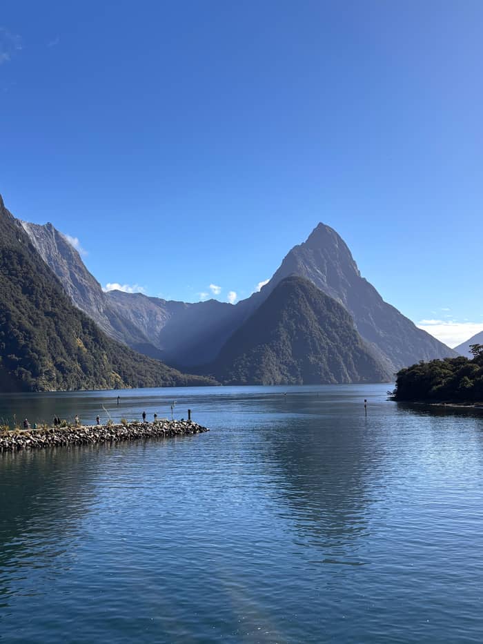
Stop by stop
Small group with lunch
Five named stops
- Mirror Lakes30 minutes
- Lake Gunn15 minutes
- Length11 - 13 hours
Your stop on the map
Summary
The stops on the way to Milford Sound from Queenstown are Te Anau, the Eglinton Valley, Mirror Lakes, Knobs Flat, Lake Gunn, The Divide, Monkey Creek, the Homer Tunnel and The Chasm.
On the road
Map of 21 stops
Pick a route, then tap a marker or a stop for notes and a Google Maps link.
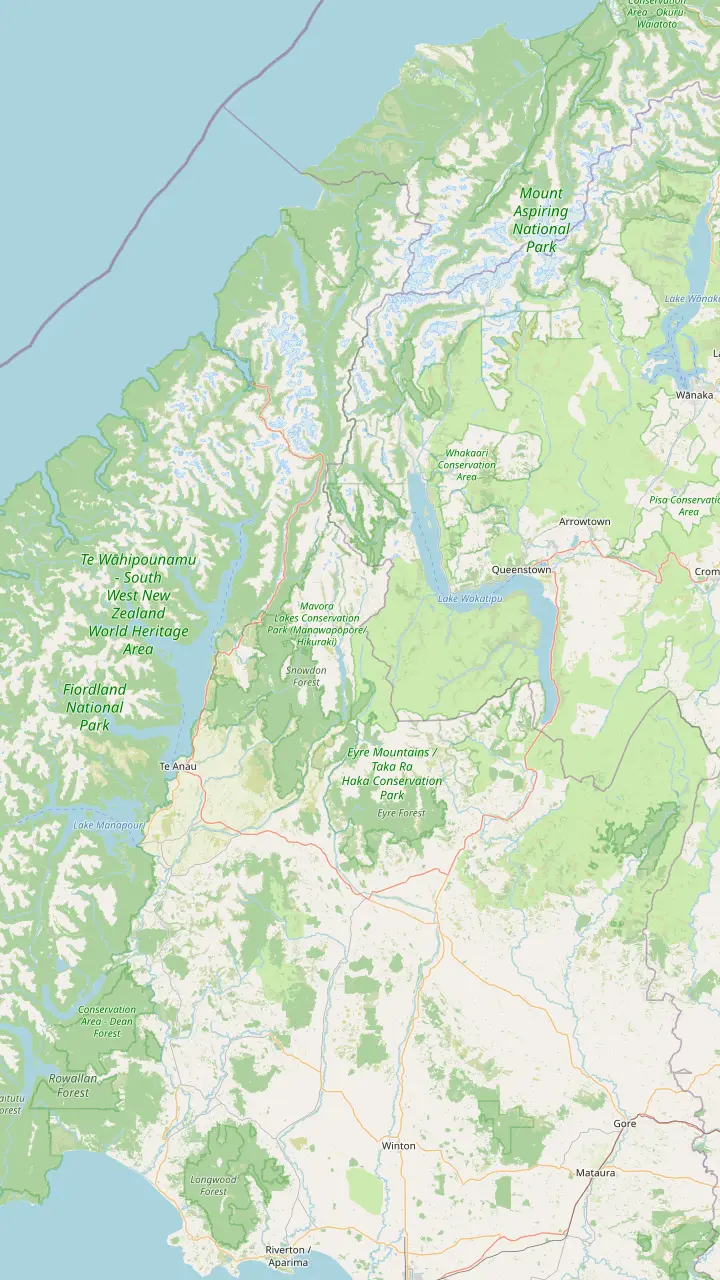
Coach day trips such as the site's own tour start at 88 Beach Street on the Queenstown waterfront.
Google MapsCoaches follow Lake Whakatipu's southern shore to this village before turning across the plains.
Google MapsA farming settlement on State Highway 6, on the way south through rural Southland.
Google MapsHere the route swings west on State Highway 94 towards Te Anau.
Google MapsThe last fuel and shops before the fiord; the Milford Road starts here.
Google MapsThe end of State Highway 94, the only road into any Fiordland fiord.
Google Maps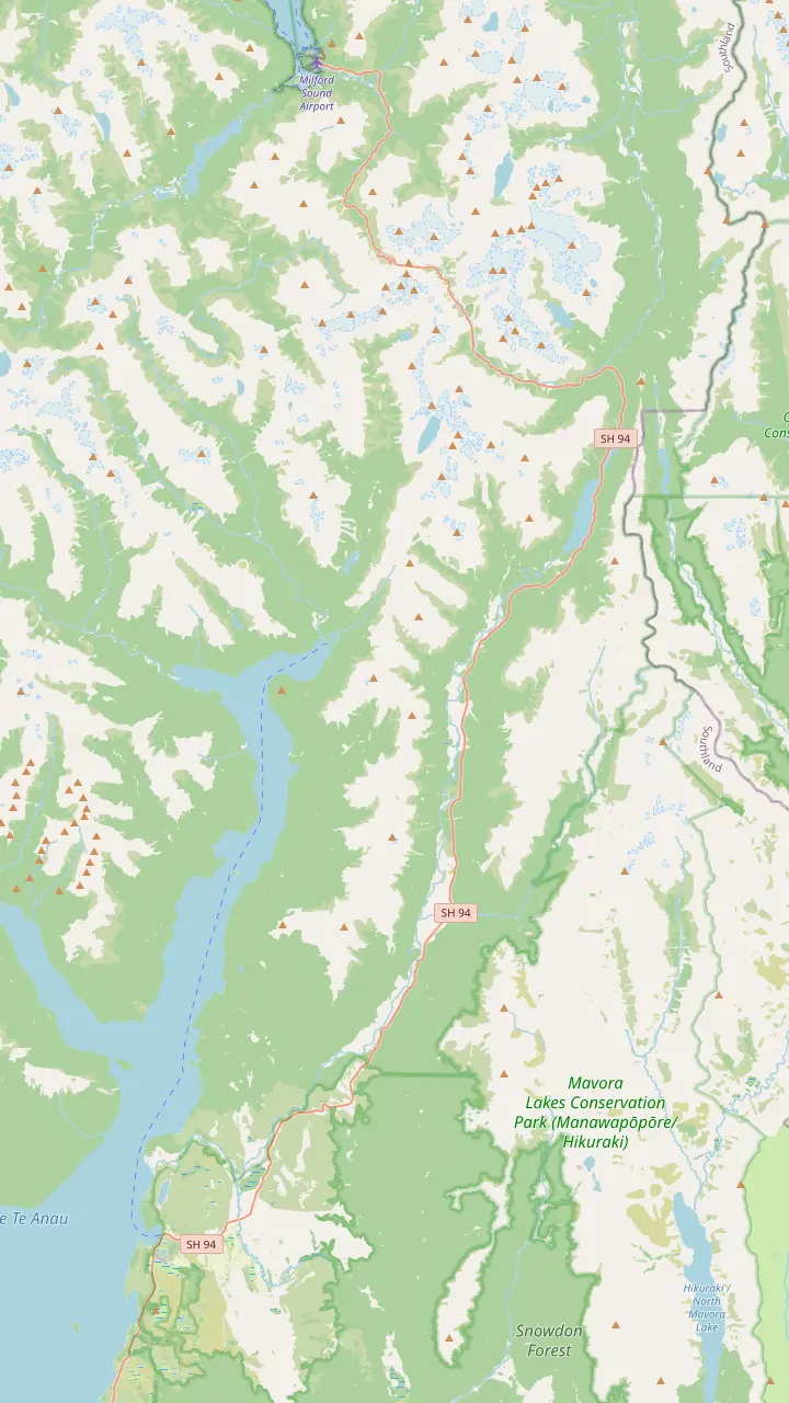
Milford Track walkers board their boat here, 28 km from Te Anau.
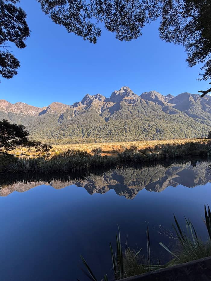
Google MapsA 400 m boardwalk to small lakes that mirror the Earl Mountains.
Google MapsToilets and avalanche panels, 62 km from Te Anau.
Google MapsThe Lake Gunn Nature Walk, an easy 45-minute loop, starts at Cascade Creek.
Google MapsThe lowest east-west pass in the Southern Alps, at 531 m, and the Key Summit trailhead.
Google MapsA swing bridge and waterfalls 10 minutes from the car park, then a steep climb to the lake.
Google MapsA signed pull-over where whio and kea are often seen.
Google MapsSingle lane at 945 m; traffic lights can hold you for up to 20 minutes.
Google MapsA 400 m return walk to the edge of the Cleddau River.
Google Maps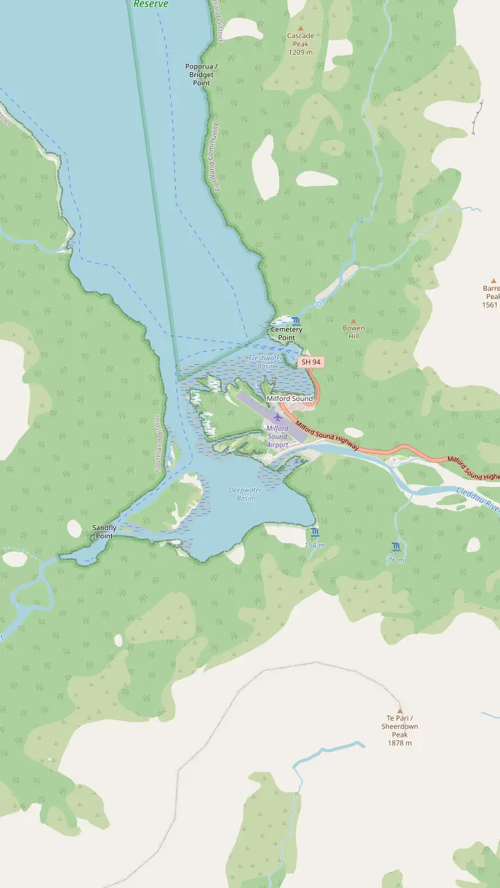
Every cruise departs here, a 10-min covered walk from the car park.
Google MapsChalets and campervan sites beside the river, linked to the terminal by the foreshore walk.
Google MapsCharter and scenic flights land here; the foreshore walk passes the strip.
Google MapsThe boat ramp for the self-guided Milford Track day walk.
Google MapsThe end of the Milford Track; a 20-minute boat ride brings walkers to the village.
Google MapsA 400 m return track with steps up to a view down the fiord.
Google MapsMap data from © OpenStreetMap contributors
The stops on the way to Milford Sound from Queenstown are half the day. Here is the Milford Road from Te Anau to the wharf, stop by stop, with the distance to each, the short walks and what to look for.
Editorial team, milfordsoundtour.quest · Updated November 8, 2026 · A 8 min read
Quick look
The road from Queenstown to Milford Sound changes character at Te Anau. The first stretch runs south along Lake Wakatipu and through rural Southland to Te Anau, on State Highways 6 and 94.7,8 Coaches use this stretch for a coffee break and little else: the site's own day tour drives 2.5 hours past the lake to Te Anau and stops there for 30 minutes. The scenery is green farmland with mountains on the horizon.
After Te Anau comes the Milford Road itself. It leaves the lakeside town and runs 120 km north through the national park, ending at the sea.1 DOC's own guide to the route numbers its stops by distance from Te Anau, and so does this page, because that is how you will read the road: as a string of lakes, valleys, walks and viewpoints, each a few minutes from the next.9 The drive can be done in 2 hours, Visit Fiordland says, but that does not mean it should be.10
Before you leave Te Anau, visit the Fiordland National Park Visitor Centre at 1 Lakefront Drive for track and road updates, and fill the tank.11,12 Then watch the land change. DOC explains that the road begins on ridges of rock debris left beside the glacier that once filled Lake Te Anau, and that the country east of the mountains sits in a rain shadow, drier than the forest ahead.13,14 Within the hour you will see that contrast for yourself.
Walks beside the road
| Walk | Where | Length or time | Who it suits |
|---|---|---|---|
| Lake Mistletoe | 27 km | 1.3 km return | Families |
| Mirror Lakes | 56 km | 400 m return | Everyone, wheelchairs |
| Lake Gunn | 78 km | 45-minute loop | Children, birdwatchers |
| Key Summit | The Divide | 3 hr return | Fit walkers, clear days |
| Lake Marian falls | 87 km turn-off | 10 minutes to the falls | Most walkers |
| The Chasm | 109 km | 400 m return | Everyone, wheelchairs |
Distances from Te Anau and walking times as DOC and Visit Fiordland publish them.15,16,26,27,28,19
The first easy stretch-your-legs walk comes early. The Lake Mistletoe Track starts 27 km north of Te Anau, opposite the hotel at Te Anau Downs, and is a 1.3 km return walk through forest to a quiet lake.15 DOC notes that the lake is home to New Zealand scaup, frogs and other wetland wildlife, and its brochure calls it a good spot for a family picnic.20,21 Coaches rarely stop here, so it is a self-driver's treat on a calm morning.
Te Anau Downs, 28 km from town, is where Milford Track walkers board the boat to the start of their hike, and a viewpoint over the Murchison Mountains, home of the rare takahē.9 It is also one of the few stops with mobile reception, DOC says, so send any last messages here.22 From Te Anau Downs the road leaves the lake and climbs gently towards the mountains, and the farmland gives way to tussock and forest.
The Eglinton Valley opens at about 52 km, with information panels on its geology and history.23 DOC describes the shift in the forest here: red beech becomes the dominant tree, broken by remnants of native grassland and wetland.24 This flat, wide valley is the classic first photo stop for coaches, and the site's own tour pauses in the Eglinton Valley before the Mirror Lakes. Look for the long straight with mountains closing in at the far end.
Mirror Lakes is the stop everyone knows. The walk begins about 56 km north of Te Anau and is a 400 m return stroll on a boardwalk.16 Visit Fiordland describes a wheelchair-accessible boardwalk to a series of small lakes that, on a still day, reflect the Earl Mountains.33 DOC calls it great for children.34 Early and late in the day are the calmest times; a breeze breaks the mirror quickly.
A little further on, near Deer Flat at 59 km, DOC's brochure notes that somewhere between there and Knobs Flat you cross latitude 45 degrees South, halfway between the equator and the pole.35 Knobs Flat itself is 62 km from Te Anau, with panels on how avalanches affect the road and on the wildlife of the Eglinton Valley.5 It has the last flush toilets before Milford Sound and some accommodation.5
This valley is a conservation story too. DOC says a predator plague hit the Eglinton Valley between 1999 and 2001, and that it has run intensive pest control there since.36 Numbers of the endangered mohua, or yellowhead, have risen, helped by a transfer of birds from Chalky Island in 2010.37 The traps you may notice beside short walks are part of that work; leave them untouched, and listen for small forest birds in the beech.
If time is short
Pick by the time you have and who is in the car.
If Just a quick leg stretch
Mirror Lakes
A 400 m boardwalk right beside the road.16
If Travelling with small children
Lake Gunn
DOC calls the nature walk a good option for children.29
If A clear, settled day
Key Summit from The Divide
Views over the Humboldt and Darran mountains.30
If Hoping to see a kea
Monkey Creek or the tunnel
If Driving in winter
Stop only where signs allow
Avalanche signs forbid stopping on the upper road.6
Tours that stop
Stop by stop
Five named stops
Home tour
Glass-roof coach
Shorter drive
Small group from Te Anau
Lake Gunn is the next proper walk. From the Cascade Creek car park, about 78 km from Te Anau, the Lake Gunn Nature Walk loops for an easy 45 minutes under tall red beech, as Visit Fiordland describes it.25,26 DOC calls it a good option for children, and there are wheelchair-accessible toilets at the car park.29,47 Beyond the lake, DOC notes, the silver beech grows stunted in the harsher climate.48
The Divide comes at 83 km.17 DOC's brochure describes it as the lowest east-west pass in the Southern Alps, at 531 m, and the trailhead for the Routeburn, Caples and Greenstone Tracks.17 Past it the road narrows and winds more, so this is a good place to swap drivers or simply rest your eyes on the view for a few minutes. Pops View, at 85 km, looks down the Hollyford Valley and is best saved for the return trip.49
If you have half a day, The Divide is the trailhead for Key Summit. Walk about 1 hour along the Routeburn Track, Visit Fiordland says, turn off at the junction and climb for 20 minutes to a panorama of the Humboldt and Darran mountains.30 A loop around the summit takes around 20 minutes more.50 DOC's brochure gives the whole outing as 3 hr return, so it fits a self-drive day but not a coach tour.27
Distance from Te Anau
27 km
A forest walk to a quiet lake, 1.3 km return.15
56 km
A 400 m boardwalk to reflections of the Earl Mountains.16
62 km
Avalanche panels and the last flush toilets.5
83 km
The lowest east-west pass in the Southern Alps, 531 m.17
93 km
A pull-over for kea and blue duck.3
99 km
The single-lane tunnel at 945 m.4
109 km
Marian Corner, about 87 km from Te Anau, is the turn-off to the unsealed Hollyford Road.51 DOC's brochure notes that the gates there swing shut whenever avalanches threaten drivers.52 The Lake Marian car park is 1 km down the Hollyford Road, and a swing bridge leads to a series of waterfalls in around 10 minutes, a short walk most people can manage.51,28 A viewing gantry above the falls makes this a fine quick stop off the main road.
The full climb to Lake Marian is a different matter. DOC says the ascent from the falls takes around 1 hr 30 min, steep and sometimes muddy, and that beyond the falls you need good fitness and backcountry skills.53,54 The reward is an alpine lake in a hanging valley shaped by glaciers.55 Visit Fiordland puts the whole walk at about 3 hours.56 It suggests following the orange triangle markers closely, as the trail is easy to lose in places.57
Back on the highway you enter avalanche country: from the Hollyford Road junction all the way to The Chasm, DOC forbids stopping.6 Inside it, Monkey Creek at 93 km is a signed pull-over where DOC's brochure says you have a good chance of seeing whio, the blue duck, and kea.3 It is one of the stops on the site's own tour, and a cold, clear drink of mountain water if you bring a cup.
Video
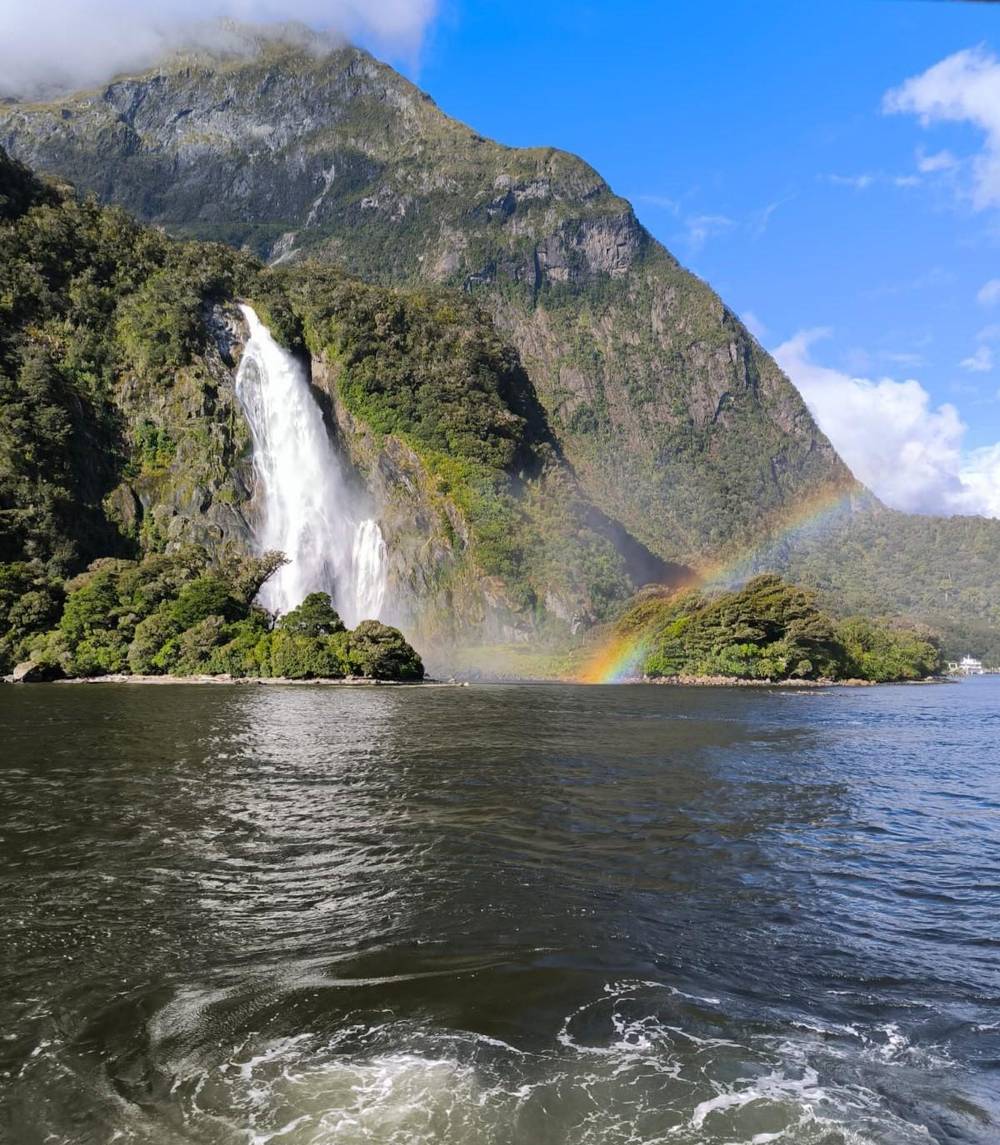
Global Travel Stories on YouTube · Video data is requested only when you tap play.
Just before the Homer Tunnel the road enters a cirque basin, carved by ice into a steep walled amphitheatre.
Just before the tunnel, DOC explains, the road enters a cirque basin, a steep-walled amphitheatre carved by ice.32 The Gertrude Valley car park, about 98 km from Te Anau, sits at its foot; the saddle route from there is for experienced trampers only.58,59 In summer, when the snow clears, DOC says Mt Cook lilies, which are really alpine buttercups, flower with daisies between the shrubs and tussock.60 Even from the car park the walls of rock around you feel enormous.
The Homer Tunnel is 99 km from Te Anau, at 945 m above sea level, and DOC's brochure gives its length as 1.2 km; Visit Fiordland says 1.3 km.4,61 Traffic takes turns through the single lane, and DOC says a red light here can hold you for as long as 20 minutes.40 The mountain parrots called kea hang around the entrance, and DOC warns they will happily investigate your belongings.31 Keep doors closed and never feed them.62 Waiting at the red light is a good time to watch them.
The tunnel took a long time to build. William Homer found the saddle in 1889, and the road from Te Anau to The Divide was finished by work scheme gangs in the 1930s.63,64 Work on the tunnel began in 1935.65 Visit Fiordland says it was finished in 1953, 18 years later, while DOC's area page gives 1954 because of difficult conditions and the Second World War.66,65 Either way, before it opened the fiord could only be reached by boat or on foot.61
Out of the tunnel the road drops in tight bends towards sea level. The Chasm car park is about 109 km from Te Anau, roughly halfway between the tunnel and the fiord.18 It is a 400 m return walk through forest to the Cleddau River.19 The viewing bridges were washed away in a storm in February 2020, and DOC reopened the walk on 24 April 2023 as a view from the river's edge only.67,68 Check DOC's page for the latest on the bridges.
The water is still the show: DOC describes rock sculpted into shapes and basins by the swirling river, and the old bridge foundations show how much force a flood carries. On the final descent, DOC notes, occasional rimu rise above the silver beech, and tree ferns and mosses thicken as the rain increases.69 The Tutoko Suspension Bridge, 116 km from Te Anau, was built in 1940 and completed the road into Milford Sound.70
Then the valley opens and the road ends at the village. Drivers with a cruise booked should budget an hour from car park to gangway, DOC suggests.71 Coach tours handle the stops for you, but the order varies with the weather: RealNZ lists possible stops at Mirror Lakes, The Divide and Monkey Creek, and the tour this page recommends names Te Anau, the Eglinton Valley, Mirror Lakes, Lake Gunn and the Hollyford River, with minutes for each.72
FAQ
DOC places the walk about 56 km north of Te Anau; it is 400 m return.16
DOC bans stopping between the Hollyford turn-off and The Chasm.6
DOC reopened it on 24 April 2023 as a view from the edge of the Cleddau River.68
Te Anau's own activities include glow worm caves, so add them on an evening before or after the fiord.74
Sources
Coach, plane or helicopter to Milford? A real person helps you choose.